From the roasting jungles in the south right up to the highest mountain in the world at the Tibetan border, Nepal is the home of superlatives. It has the best trekking in the world, best whitewater rafting, best mountain biking. It has 8 of the 10 highest mountains in the world, the shortest paved road system in Southern Asia and the densest concentration of World Heritage Sites. It has both the oldest Buddhist shrine and most sacred Hindu pilgrimage sites in the world, and is the world’s youngest republic. All in all, a nice place to have a holiday.

From 30,000 feet, cruising towards Kathmandu, Everest woke me up looking like it’s parallel to the plane
But I didn’t actually have many expectations while flying in from Thailand, after a week spent on the beach. I expected just to spend a couple of weeks hiking around with Eileen and Suzi – who were flying out for their holidays – before heading on to India.
First thing we did was hop on a bus down to Chitwan National Park, in the steamy south of the country. We stayed down there for an intense 2 days with all the snakes and elephants and rhinos and mosquitos and whatnot.
We went on an elephant-back tour of the edges of the park where I was unfortunately relegated to the back seat and had to endure the toxic fumes produced by the elephant’s exertions. Also this meant that, while the girls up front were cooing away about some rhino doing backflips that they had a great view of, I was stuck looking the other way into a small bush the elephant had decided to defecate into. Nice tour though. We saw a huge python cross the path ahead of us (I was busy studying a large tree the elephant was backing into at the time) and had great craic washing the elephants afterwards in the river.
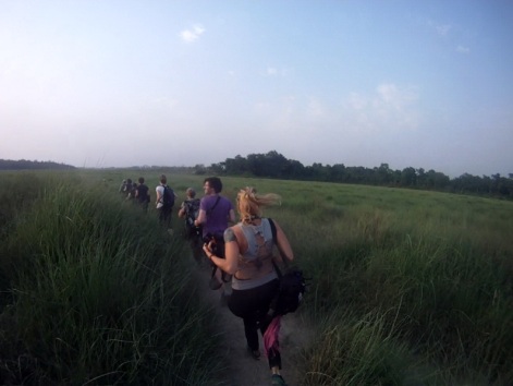
That evening we went on a walking safari into the park. Our guide – Raju – had been really relaxed and joking around up until then but once we waded across the river into the park he gave us a pretty stern speech on following his instructions in the event of coming face to face with rhino, tigers or sloth bears (apparently the most dangerous animal in the park). I was uninterested at this stage – looking around for tiger prints – but his advice did actually have a practical element 20 minutes later when we had to run away and climb trees from some rhino who had smelt us in the long grasses and had started charging. Luckily, they lost interest after we climbed the trees and went off in the other direction.
Adrenaline was pumping again an hour later when we had to run away from more rhino who had started fighting on the edge of a riverbank we were nearing.
As we were fleeing the scene – binoculars and DSLRs akimbo – Raju spotted a tiger on a bank above the river, about half a
kilometre away, watching us. We caught our breath for 10 minutes in a scrubby bush and sure enough it appeared again, sauntering across the ridge with the sun setting behind it before disappearing into the trees. Raju was ecstatic – apparently sightings of tigers are very rare because one tiger’s territory covers over 20km squared – it was his first tiger sighting in months.
The next day we careered dangerously up the hills to Pokhara, bumping around in the back seats of a ubiquitous Indian Tata bus. Pokhara was in the middle of strikes that had brought the country to a halt. The people were protesting against the government’s failure to pass a new constitution dividing Nepal into federalized states. This was first promised to the people 60 year ago, but hasn’t yet been passed. Shops and schools were closed, and the whole country had come to a standstill. We wanted to go to the mountains – less than an hour away – for some hiking, but no buses were running. So we had to pay for a taxi to take us out under cover of darkness – dodging around piles of burning tyres meant to block the street. We hiked for 2 days up valleys full of
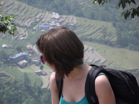
rice terraces, then rhodadendron to Poon Hill, a 3210m high ridge with amazing views of the Annapurna Range. We reached the top at 4.30am, just as the sun was rising over the mountains, turning the wind-haze around the peaks fire red before rays of light blasted out from behind ‘fish-tail peak’ (Machapuchare), a 6993m peak sacred to Nepalis and off-limits to climbers.

Sunrise from Poon Hill. On the left is Dhualgiri (7th highest in the world). Near the right is “Fish-tail Peak”
After taking in the views it was 3 more days walk back to Pokhara, down steep steps that zigzagged into the deep valleys, past people carrying all sorts of commodities from boxes of noodles to fridge-freezers, and past many tourists. We spotted one girl straight out of Phoenix park walking her terrier on a short lead up the hills, wearing flip flops and ray-bans. Behind her, her porter staggered up the hill carrying her massive backpack. A common sight in the Himalayas.
And so we left the mountains and after an extended celebration in Pokhara we headed back to Kathmandu where Eileen got her flight back to Galway General Hospital.
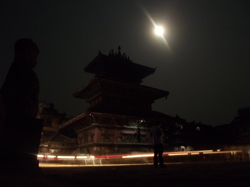
Kathmandu’s a great city. It’s totally filthy, smelly and noisy, but every corner you turn is a blitz of colour and bizarre mayhem that grew on me after a while. We wandered around the market squares and alleyways, finding in one small square a performance where four men, deep in a trance, performed some elaborate ritual that we couldn’t follow but was watched intensely by each of the enraptured audience.
Another time in Kathmandu I was cycling down a street when a 4 storey tower of sticks and wood rumbled out of a side alley, followed by hundreds of people dressed in bright red and chanting a mantra of some sort. It turned out to be Rato Machhendranath, a ritual that happens twice yearly where statues of Machhendranath (the god of rain and plenty) are transported across the city on towers placed on wagons. It’s part of a complex series of rituals necessary for a good rainy season to fall on the Kathmandu Valley.
Unfortunately, as the chariot was making its way slowly down the street, the top got entangled in an electricity line and it had to halt or the whole thing would have come crashing down. Not to be deterred, the followers lit fires and immediately set up temporary shrines around the bottom of the wagon and started blessing passers by. This sort of thing happens every day in Kathmandu.
Before Suzi headed back to Ireland too, we headed out on a 2 day rafting trip down the Trishuli River, near Kathmandu. It wasn’t technically challenging – we didn’t really have to paddle to control the boat much – but the rapids were pretty huge and the force of the rainy-season river impressive. We followed the river along forest-edged hills with monkeys climbing around the cliffs falling into the river, and camped out on the river’s edge the first night. The rest of the crew were made up of Indians who were in a high state of excitement the whole time but didn’t have a clue how to paddle. In the flatter sections we could swim and it took one guy 5 minutes to realize it was his lifejacket that was keeping him afloat, not his desperate thrashing around.
After this, Suzi flew back home and I applied for my Indian visa, which took a week to process. In the intervening days I rented a bike, took a bus up to the Tibetan border and cycled back to Kathmandu. Up at the Tibetan border I went out to look at the “Friendship Bridge” – the only bridge that links China and Nepal. It’s built 100 metres over a churning river and looks up at the Tibetan monastery of Khasa on the mountain above. I was chatting to a Chinese girl and taking photos when a small man in black clothes ran up and snatched the camera from my hand. Acting instinctively, I snatched it back, whereapon he snatched it back again. I asked him what he was doing. He muttered “Police” while looking through my photos and deleting them.
I asked him to show me his ID, or give me my camera back, as he didn’t look like a policeman. I thought it was a scam. At this, he quickly put the camera down, twisted my arm around and handcuffed me. Surprised me a little, that did. Luckily a Nepali police woman was walking by (this was on the bridge – neither in Nepal or China) and calmly asked the man in Chinese to uncuff me and explained to me that it was illegal to take photos (there had been no warning signs to this previously). I thanked her and scooted back to Nepal. I wasn’t that surprised when, 3 days later, I saw in the news that Nepali truck drivers had blockaded the border with their vehicles in a protest against “Chinese police brutality” that included their vehicles being vandalized and them being imprisoned without charge for days on end. I got off lucky.
Over the next couple of days I cycled back to Kathmandu down the Bhote Koshi river valley, over the hill to the Sun Koshi river valley (great fish restaurants) and back to the city via Bhaktapur, an old city state that now has World Heritage Site status, which means it’s much cleaner than Kathmandu, and receives lots of Chinese bus tourists (oh yay). In Bhaktapur I wandered around, visiting a local paper factory whose owner eagerly then showed me around his friend’s brick-making factory. Fun day.
A couple of days later I was on the way to Mount Everest, on a trip co-concocted with Dominik Werner, a friend I had met up with in Kathmandu. We first took the bus to Jiri, acquiring premium rooftop seats for the latter part of the journey. This meant clinging to the top of the bus as it flew around narrow bends, climbing up to Jiri: end of the road and the start of the 2 week hike to Everest base camp. The first couple of days went well, but on the 3rd day Dominik realized he had left his passport in the hostel the night before, so went back to get it.
That left me waiting in Nimar, a tiny little village of a couple of houses clinging to a hillside in the middle of Nepal. The hostess was mother of 5 children, and that day I took them to school – an hour long hike over the hill. The school – like many others in the region – was started by Edmund Hillary a couple of decades ago, and remains funded by his foundation. Buildings, textbooks and materials are all supplied by the New-Zealand based organization, while the teachers are supplied by the government. Great wee school. After 1 O’clock, I went home with the two youngest kids, Tenji (5) and his sister Furwa (7). Along the way they showed me the best places to pick berries, and we spent the rest of the day playing card games, trying to prevent the pet goat from eating our clothes, blocking the pet water buffalo from going into the kitchen and climbing the hill to the buffalo and cow pastures to bring them back for milking before dusk.
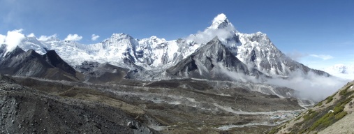
Over the next week we slowly gained altitude up to the Chukkhung Valley, between Ama Dablam (the ‘most beautiful mountain in the world’) and Lhotse’s South Face (not yet climbed, attempted by many). By that time we had already climbed 2 high passes, ascending a total of 10,550m and descending 7,300m, more difference than climbing Everest itself (although I hear it’s a tad tougher). The landscape had changed from terraced fields to open treeless pasture, the fuel changed from dried wood to yak dung, and the views changed from arable hills to snowy peaks. The Chukkhung Valley is at 4700m – the highest I had ever been by far – and it’s where I began to really feel the altitude. At that height oxygen levels are 62% that of what they are at sea level. Often people’s bodies can’t cope with this, which leads to fluid leaking into the lungs or brain that – in a bad case – can kill in a matter of days. It’s really important to ascend very slowly above 3500m – which we had been doing – and rest a lot. We spent two days up in the valley acclimatizing before heading on to base camp.
The first day was particularly hard for me. On a hike up to Imja Tsho – a glacial lake at 5100m, right below a massive rockfall and Island Peak, one of the popular low-altitude (6189m) peaks to climb – I felt pretty bad altitude sickness. My lungs suddenly seemed shallower, my legs heavier and the sun stronger. I had to sit down at regular intervals when bouts of nausea made me dry- retch into the dirt. My vision narrowed at times and I had a pounding headache. Fun times!
That night when we got back to our lodge at 4700m (you’re supposed to sleep at 300m lower than the highest point you reached that day to aid acclimatization) I took two paracetemols and a Diamox (altitude drug that thins your blood to allow oxygen to reach your vital organs faster) and passed out for 12 hours. The next day I felt great again! Most people feel the effects of altitude at different stages but Dominik didn’t feel anything up in the valley. In fact, I think the higher we got the more energetic he became. Some people just aren’t affected by the altitude.
The next day we climbed Chukkhung-ri, a 5580m peak looking up onto Lhotse, the 4th highest mountain in the world, before heading over the Kongma pass the next morning to cross the Khumbu glacier and find the way to base camp. Everest base camp itself is fairly uninteresting – just a series of ruins of camps left by the various expeditions on their way up the mountain.

The Japanese guy smoking a joint at 18,000feet, one of the reasons he might have got lost the day before
But the views up the icefall are pretty spectacular, and we spent most of the morning dandering around there. At one stage we spotted an umbrella out on the glacier, under which we found a Japanese guy asleep who – when he woke up – told us he had got lost the day before looking for base camp and it had got dark before he had been able to find his way off the glacier. He had slept out on the ice – an extremely dangerous thing to do given the glacier is always cracking and seperating as it moves slowly down the valley. We showed him the way back to Gorak Shep – the nearest lodge – where he had 5 helpings of rice and dhaal and the next morning accompanied us up to Kala Patthar, a 5550m peak overlooking Everest.
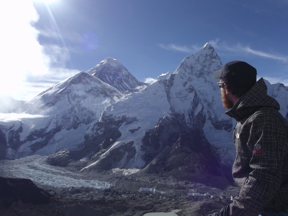
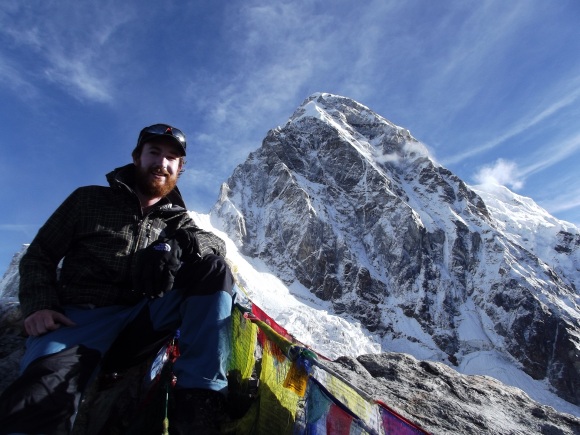
We left the lodge at 4am, and reached the top around 6.30 to views that guidebooks describe as ‘breathtaking’. The Everest ice fall was slowly lighting up as the sun rose ahead of us, with Nuptse (7861m) rising to a jagged point to its right. Everest itself was cutting shapes behind. I could see up the South Col to the Hillary step – the single ridge of rock that leads to the summit – with the summit itself surrounded by its weird halo-esque snow rings that appeared and disappeared as the hurricane-force winds up there dipped and swelled. To the left of Everest we could see Lho-la, an ancient trade pass to Tibet now impassable because of the work of the glaciers. 150m vertical drop below us a glacier lake shone in the strong sun and behind us Pumo-ri rose 2 kilometres above our heads. Awesome.
We sat up there staring up at everest for a couple of hours. It’s not only a nice thing to look at: for many people it’s an expensive and dangerous obsession. Hundreds of people pay up to $70,000 to try to climb it every year and many die in the attempt – 1 out of every four that make it to the top, in fact. It’s a massive money maker for many local sherpa families, who must be among the richest people in the country. Most kids are educated in private schools in Kathmandu or outside the country and the top climbing guides live in the US or England in the off season, flying back to make a small fortune every year guiding starry-eyed (and generally rich) mountaineers to the top.
After all that, we teamed up with a French guy to go over Cho-la, a 5330m pass that leads to the Gokyo valley and much-famed Gokyo lakes. The first night we spent in a fairly dire semi-abandoned cabin in Dzonghla, at the foot of the pass. The place was deserted, cold and full of rats and we spent the evening huddled around a candle eating toblerone and playing cards in our sleeping bags. After a fairly miserable cabbage soup the next morning we set out for the pass through yak pastures and up a steep crevasse in the rock to the glacier that leads to the top.
By then it was around 10am and the sun was quite strong. At this time of year the sun is strong enough to melt the ice that holds the rocks on the high mountains, and they bounce down the sides at regular intervals. We got across one particular rockfall OK, but only just – one group of huge rocks missed Dominik by a couple of metres as he came through behind myself and Samuel. It’s not all that dangerous as long as you keep your wits about you – there are always rocks to hide behind! Climbing to the top of the pass was tough as well – we had to climb an exposed glacier above an icy lake to the flags at the top. The problem with these passes is that they change every week or so, as glaciers move and avalanches fall, so nobody really knows the way. Maps are incorrect and guides themselves often get lost. Cho-la was difficult, and I think it’ll get more difficult as the years go by. Careful now.
The Gokyo Valley was very misty, so we only spent a day there before going over our third pass – Renjo-la – to Thame, where the Buddhist festival of Dumje was in full swing. Up at the local monastery there were various rituals taking place including burning an effigy of ego and throwing blessed rice around the place. Great craic. We had just missed the annual arrival of Tibetan traders, who still climb over the 4 day Nangpa Pass from Tibet to trade with the sherpas. Nowadays though, instead of trading in caravans of salt and leather they bring yak loads of Chinese TVs, clothes and fake iPads. There were still a few camped out along the route but most had gone back over the pass a couple of days before. Thame is home to a lot of famous everest summiters, including Tenzing Norgay (first man to climb Everest back in 1953, along with some Kiwi guy who tagged along) and Apa Sherpa, who has climbed to the top an unbelievable 22 times, mostly without using additional oxygen. We had lunch in his lodge one of the days. He was away in LA living the high life, but his sister cooked us up a mean Dhal Bhat.
It was time for the last stretch back to Kathmandu, over the 5755m Tesi Lapcha pass and down the Rolwaling Valley to the roadhead, 4 days fast hike away. Most tourists fly out of the everest region, but having the luxury of time and wanting to complete the entire circuit on foot we had targeted Tesi Lapcha from the start. Dominik still had a month left on his visa, but mine was getting short, so he decided to come halfway up the pass for the views and then turn back for another couple of weeks in the Khumbu region. We hired two local climbing guides to take us over the pass, which 20 years ago was safe enough to bring yaks and horses laden with goods over but nowadays is rarely used.
It took two days to go over the pass, first climbing 1300m to Ngole, which consists only of a couple of huge rock caves that we camped in up at 5100m, shielding us from the elements. All the hiking we had done up til then had been baby-steps compared to what was to come. The next morning we started at 2.30am for the top, climbing endlessly over boulders that gave way to loose stones and eventually bare ice. Dominik turned back at this stage, and the rest of us hurried to the top of the valley, which abruptly ended at the bottom of a 100m high ice-wall, angled at about 70 degrees, leading to the pass.
I hadn’t realized we were going to be ice climbing and was fairly terrified pulling on my crampons and tying into the rope. We remained tied together slowly up the ice, Ang Dhora (lead guide and beast of a man – climbed everest twice and attempted the West face this year with a Canadian expedition) painstakingly cutting footholds with his ice axe for myself and Karshang below me to step into. We reached the top of the wall from where it was a couple of hundred metres to the pass along a narrow ledge with a 200m drop on our left side back down into the valley we had come from.
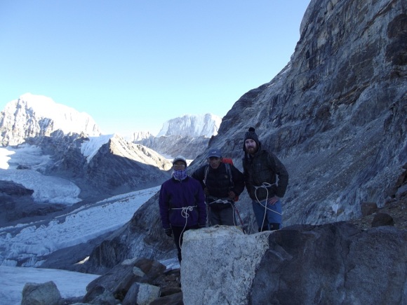
On top of Tesi Lapcha (5750m)
R-L: Me (24, inexperienced tourist); Ang Dhora (27, multiple everest summiter); Karshang Lama (60, local electrician)
We reached the top at 4.30am, just as the sun was rising above the Khumbu region on one side and the Rolwaling on the other. Probably the most stunning views I’ll ever see, and in my high altitude induced mental state I got a bit emotional! We couldn’t spend long at the top, because as the sun rose it started melting the sheer glass-like walls of ice on either side, sending small stones skidding down the surface of the glacier to our feet. Going down was much tougher, gripping on the ice was very tiring, and we had to abseil down a 20m vertical drop from the first glacier onto the second. All along the glacier it creaked and popped ominously below us, and we kept going fast without rest, reaching the upper Rolwaling Valley at around 8am. By this stage waterfalls were forming off the edge of the glacier and we watched a massive avalanche the size of Europe fall down a towering mountain above us. From here it was an exhausting 3 hours across a rocky glacier and up over yet another rockfall to the end of the valley. At this point the Rolwaling glacier, which is ripping the sides of the mountain out on its way downhill, meets another glacier in a collosal mass of ice, stones and mud. The result is a huge lake which, if the stone wall gives way, will pour down into the unprotected valley below and wash away all the people who live there.
4 hours later we were in Nagoan, the first settlement in the Rolwaling region that consists just of a few yak herders’ houses and a monastery. We were welcomed into one of the shacks for the evening by a lonely old yak farmer, who plyed us with plenty of roxy and chang (the local rice and potato based liquor) and fed us piles of thukpa (potato and yak stew). We had walked for 12 hours pretty much non-stop, and I was exhausted. Karshang and Ang Dhora though were already preparing themselves for the climb home. They left at 2am that night, hoping to make it to Thame in a day. I myself horsed it down the pristine valley the next day, walking through the pain as my feet fell apart.
I was only back in Kathmandu for a couple of days rest before I rented out a beast of a mountain bike and cycled the Annapurna Circuit, an area of mountains and deep valleys in the West of the country. Most people (naturally) hike this route, but it’s been done by a couple of bikers, said google. I was forewarned to expect to carry the bike a lot of the time, but it was a lot less difficult than I expected. The main problem was the rain – I started the route in the Marsyandi valley, which is the wettest area in Nepal. The road was an endless quagmire, I had to climb under and through waterfalls falling onto the road with the bike on my shoulder but after the second day it began to get much easier.
The upper areas were a lot drier, and there were a lot of great trails and downhills to follow along the Manang Valley. I had a day off the bike in Manang, where I climbed up to Tilicho Lake (5090m – the “highest lake in the world” according to my map) through landslides and weird sandstone formations. It was pretty barren up there and noisy – half the mountainside seemed to be falling into the lake and the other half was preoccupied with avalanches tearing down its slopes. It was Dad’s birthday that day too, so it seemed fitting to get in a good hike for him.
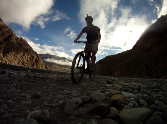
For the next two days I cycled and pushed up to the Thorung-la pass (5400m) and onwards and downwards into the Muktinath Valley, a desert valley in the isolated Mustang region.
This was the best part, as I bombed it down the hill and across barren hillsides populated only by goats to Kagbeni in a couple of hours. The final two days were tougher than I had imagined – cycling down another rain-soaked valley full of mud where I had to ford rivers every half hour and got stuck in the mud every 10 minutes.
Thus ended the stint in Nepal. I got my beard shaved off back in Kathmandu (massage and tea included) and booked myself onto a bus to the Indian border. 30 hours later I find myself in Haridwar, in Uttarkhand state. It was a great journey to get here – through the lower Terai and across the border at Mahendranagar with 16 Nepali guys heading to Punjab to work as door-to-door salesmen.

Near the end, my beard was provoking unfair comparisons (never mind the ginger-bashing). Had to shave it off
I arrived into Haridwar at 2am to find the place heaving with tractors hooked up to massive soundsystems tearing it through the streets and teenagers in bright orange robes running along the Ganges with huge fire-torches. I hadn’t realized that I’ve arrived slap-bang in the middle of the annual Kanwari festival, when 17 million devotees of Shiva come to Haridwar for a dip in the river. Busy times. You have to admire a religion that sanctions a yearly journey to a riverside resort with your friends for a swim. Everyone’s having a great time here. In my country the dominating religion encourages you to go to Lough Derg to break your feet walking in circles around a couple of freezing cold rocks. Less fun.
Nepal highlights:
– Walking safari, Chitwan N.P.
– Tesi Lapcha pass, Solukhumbu
– Biking down the Muktinath Valley, Mustang
Nepal lowlights:
– Kathmandu’s dogs

Kathmandu’s Dogs: harmless during the day. At night they transform into howling savages, chasing me down alleyways and having unresolvable fights outside my window just as I’m trying to get some sleep.
– Nepal’s roads
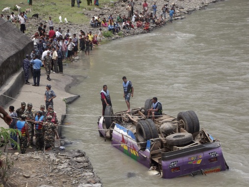
Bus disaster I came across on the way back from the Tibet border. An hour before, this bus had overtaken me on a bend and the conductor and people on the roof gave a cheery wave. Every time I took a bus journey in Nepal we came across at least one accident.
Books:
Dave Grohl – This is a Call
Jon Kraukener – Into Thin Air
George Orwell – 1984
Richard Branson – Autobiography
Heinrich Harrer – Seven Years in Tibet
Music:
Florence and the Machine – Lungs
Animals as Leaders – Weightless
J.S. Bach – The Brandenburg Concertos
Herbie Hancock & Jaco Pastorius – Live Voyage
Radiohead – The King of Limbs
The Bad Plus – Give
The Beatles – Revolver
Morton Feldman – Patterns in a Chromatic Field


